Friday, October 15, 2010. Virginia Beach, VA to Hickory, NC
We left VA Beach at around 4:30 made it past Emporia and then grabbed Rt. 85 south. Missed the turn at Winston-Salem so had to jog north to get back on track. Stayed in Hickory, NC at a Best Western and, thanks to Corky, got a good government rate.
Saturday, October 16, 2010. Hickory, NC to Smokemont Campground in the Great Smoky Mountains.
Woke up at around 6:30, showered, and took full advantage of the free breakfast. Corky chatted up a women’s volleyball team heading to a tournament as Harry got the last opportunity for a late sleep.
Hit the road and got on the Blue Ridge Parkway at Jonas Gap to take advantage of the beautiful views of the mountains and maybe see a bear. Beautiful drive. Saw signs for Mt. Mitchell State Park and, since we had the time, pulled in to investigate. Parked and walked the last 100 meters to the summit of the highest peak east of the Mississippi (at 6684 ft.). Now that wasn’t so hard was it?
 Harry on top of Mt. Mitchell
 View from Mt. Mitchell
Had lunch at the park lodge and then continued on the Blue Ridge Parkway to the Great Smoky Mountains. We arrived at the Oconaluftee Visitor's Center, filled out, and deposited our backcountry permit.

I convinced Harry and Corky to drive through Cherokee on to Sylva so that I could get my fishing permit. Lots of little towns with living mainstreets. Nice to see. Got the permit and a few small flies and winded our way back to the Smokemont campground.

Moonrise over the Smokies
We set up Harry’s tent in no time and then went back to Cherokee to Pauls for dinner. I opted to stay away from any camp food groups and had a fried fish sandwich and fries (that would be burned off in the trail miles to follow). Food was mediocre at best. Headed back to Smokemont in the dark and sleep came quickly.
Sunday, October 17, 2010. Smokemont Campground to Kephart Prong Trailhead to Sweat Heifer Trail to the Appalachian Trail to Icewater Spring Shelter.
Woke up as late as possible because it was freaking COLD! OMG we were freezin’ I ran to the bathroom and its heater was anemic! Got back to the tent and immediately searched out my gloves, wool hat and extra layers. Got water and commenced to boil and made everyone’s coffee. Corky and Harry got up and rushed off to the WC while I prepared breakfast. Pack-it Gourmet’s Bangers and Mash. The breakfast was fine, but I find their preparation too laborious and the smell of their sauces take weeks to leach out of my bowls. One still smells like Ya Ya Gumbo from last summer! I’m done with Pack-it Gourmet. We rushed to get the tent down and threw it in the back of the van. Cleaned up our backpack content “yardsales” making sure not to leave anything behind. It was so cold I packed an extra long sleeve shirt and long underwear (Note to self - both turned out to be unnecessary). Our AT shuttle driver arrived and we parked our car in one of the open spaces in the Smokemont campground since we were told that cars left for days at the trailhead on Rt. 441 were obvious and semi-routine targets for theft.
We rode the 3 miles to the Kephart Prong trailhead and took the traditional “before” hike snapshot.

We’re off! The trail was easy and we had fun crossing the Oconaluftee River on a series of foot bridges.


The beautiful Oconaluftee River watershed...

First stop at mile- 2 was the Kephart Prong shelter.

Just beyond the shelter we found the Sweat Heifer trail and up we climbed.

We took breaks along the climb and stopped for lunch at a beautiful cascade.

After lunch we continued to climb, break, climb, break, and so on. Saw a turkey on the trail. We made it to the junction with the AT at 3 pm – just steps from a beautiful overlook. We stopped at the junction and snacked and changed socks.


Only a little more up in the mile it took to get to the Icewater Shelter.

Icewater Spring Shelter

View from Icewater Spring Shelter
We were first to arrive at 3:45 and quickly claimed our sleeping spots on the top bunk. Others filtered in as we were pumping water. We made our Mountain House dinners at around 6 pm amid more arrivals. We checked the maps and chatted with our shelter-mates. Met a guy that designed the Arnold Palmer golf course in VA Beach. A group of six 20-somethings arrived and debated whether to stay (and sleep on the ground) or go (and hike about 5 hard miles up to the LaConte Shelter) since they didn’t have reservations at Icewater Spring. They went back and forth and finally decided to stay to the consternation of at least one or two. They settled down, made dinner and waited to see if they’d get a spot inside for the night. We all made room and I think the 14-person shelter slept 18 or 20 that night. One of the youngsters was an animator for Dreamworks who worked on How to Train Your Dragon. He had a killer camera and was showing us how to do some really cool time lapsed photography. One of the other youngsters had just come from Alaska and was on her way to be a ranger in Yosemite in the winter. Seemed like she had the perfect demeanor for the work. Nice girl.
We also saw this big fat grouse hop up in a tree and then work his way to the outer branches to feast on the tree’s berries. Cool!
The Icewwater Spring Shelter is a great place for the sunset/sunrise cause there are great views of the mountains and valley below with some nice trees to frame the view.

Icewater Spring Shelter: Sunset over the Great Smoky Mountains!
 Wish you were here?
We enjoyed the show and the company. I was ready for bed after sunset, but Corky and Harry made me stay up until 9 pm before going to bed. I barely made it.
Monday, October 18, 2010. Icewater Springs To Peck’s Corner Shelter
As good as the sunset was, the sunrise was even better. Great color and cool cloud patterns.
 Sunrise at the Icewater Spring Shelter
Ole reliable oatmeal for breakfast. Corky wasn’t eating because he was too busy chatting everyone up. That’s how he got his trail name... If not last, we were next to last to leave the shlter, but right before we left, we met a young couple with an Australian Blue Heeler pup. Corky melted. Picture-taking ensued. Then we met a couple from AL. More chatting. We finally got underway by 10:45 am. Tom, J.C., Will, help me please!
We headed for Peck’s Corner Shelter will lots of up and down planned for throughout the day.

On our way to the Peck's Corner Shelter from Icewater Springs Shelter
About 2 miles down the trail we made it to Charlie’s Bunion. Everyone we talked to and everything I read said it was a must see. They were all right! Nice picture spot. There was a kid there who was just climbing down from the pinnacle and we were told he just lost his jacket. It and his daypack were tumbling off the cliff and he almost fell to his death lunging for his stuff and could only retrieve the pack. No way he could recover the jacket by hiking down. Bye bye…. We carefully took our pictures and left all our gear in safety against the trail and cliff wall.
 Charlie's Bunion - people fall off and die every year!
 Corky on the tip of the Bunion
 Bunion on the left; Smokies as far as the eye can see...
 Vegetable and mineral at the Bunion
Back on the trail, we made our way to the Dry Sluice Gap junction (the alternate trial up from the Kephart Prong Shelter). Sign says 6.2 miles to Peck’s Corner. We past one set of south-bound thru hikers who had left Maine in June. We stopped for lunch and then worked through lots more up and down before we made it to the Hughes Ridge Trail that led to the Pecks Corner Shelter.


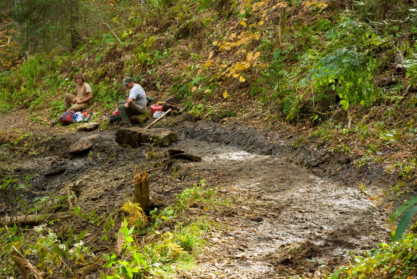
 Work on the trail
It was 0.4 miles downhill to the shelter (which meant 0.4 miles uphill for the start of tomorrow’s hike – crap) and on the way down we ran into some Park employees doing trail maintenance. Building runoff diversions – hard, muddy work! Said we appreciated their work, saluted, and kept on.
Made it to the shelter. My little MSR 11 oz white gas fuel bottle was making more meals than planned so we boiled water for an après-dinner coffee treat. Busted out the maps and discussed a shortcut that would shave a day off the hike and lead us directly back into the Smokemont campground. Harry rejected! He’s a trooper!
 Peck's Corner Shelter
 Privy with a view
Trail book says TriCorner Knob Shelter is remote and smack dab in the middle of the Smokies. Who can resist “remote”? Yeah, we want to be deep in the Smokies and be as far away from roads as possible – only a piddling 7 miles at that point, but as far away as we could be. We want remote!
 Pumping Water; typical water source on our trip
Corky and Harry pump water and I hike down the ravine in search of trout. The guide book says a tributary of the Enloe stream flows from behind the shelter. At the water source, the “stream” is a trickle. I hike along the drainage to see if it opens up into anything bigger.
 Woods in the stream drainage
After about a half a mile of picking my way downstream, and keeping an eye peeled for bears, the trickle intersects with a bigger water course. At least I can hear it! It’s getting dark, so I tie my red bandana on a tree stretching across the stream at the intersection so I know how to get back up the right ravine if I’m coming back near dusk.

 The trickle begins to "widen"
After about another ½ mile downstream, I find a promising mini waterfall and plunge pool. Only about 8” deep, but broad enough I think and highly oxygenated.
 "da pool!"
Not a cast so much as a dangle and a fish rises to the offering. Not sure what it is, but it’s small. I place the #16 Henryville Special (one of my all-time favorite flies) at the base of the fall and the trout takes it with gusto. The gods favor me with a beautiful 6” GSM brookie. I’m in heaven!
 "GSM gift!"
That’s all I need to make my day complete! The brookie is quickly returned to his little wet world unharmed and I pick my way upstream as the light fades and my bear radar is on high. Water, fish food, a mile away from the shelter, this is where I’d be if I were a bear! Found my bandana without incident and made it the rest of the way back to the shelter before full dark. Noodles for dinner. We hang the packs up in the dark, and again stay up until 9 pm before being allowed to sleep.
Tuesday, October 19, 2010. Peck’s Corner to Tricorner Knob to Laurel Gap Shelter.
It was a beautiful sunny morning at Peck’s. We found out that two other guys in the shelter were also heading to Tricorner Knob. One left before us, the other after. It was a short hike of about 5.3 miles to TK, but with three climbs over Eagle Rock, Mt. Sequoyah and Mt. Chapman (the fourth highest peak in the GSM). We made good time up to Eagle Rock where we took a break for water and some snaps.
 Eagle Rock
 Elevation marker at Eagle Rock
Next up, Mt. Siqouyah, but we rolled over that peak. Day-3 climbing was still hard, but rest-recovery was much quicker.
 On our way to Mt. Chapman in the more "remote" sections of the Great Smoky Mountains
Hiking up Mt. Chapman was tougher. On the slopes, we caught up with the guy who left before us and we leap-frogged at rest points. We ate lunch at the top of Mt. Chapman and made quick work of the downhill to the TK shelter. Arrived at 1 pm after about 2.5 hours of hiking.
 We're here!
 Tricorner Knob Shelter
 TK water source
It was a very nice shelter – one of the nicest on our trip. Since we arrived so early, as we took off the packs and surveyed the area, Corky hatched a plan to continue on for the next 6 flat miles to get to the Laurel Gap Shelter. There was a high probability that it would rain the next day and he reasoned that it would be better to hike the 5 miles when it was sunny and nice and we had our legs than to risk having to hustle to knock out 10+ miles on the last day and in the rain. Sounded good to me. Although we acted all democratic as we put the idea up to a vote, I think we strong-armed Harry a little. He worried about not having a reservation at Laurel Gap (reasonable), but we poo-pooed this mid week risk and he unenthusiastically relented.
Good bye TK. Packs back on, and surprisingly the trail headed up! I felt Harry’s mind darts piercing my back as we climbed. Thankfully, the climb or the mental blood-letting didn’t last long. The Balsam Mountain Trail dropped about 500 vertical feet over 6 miles on the way to the Laurel Gap Shelter.

 Dead logs provideing nourishment for the next generation...
 White rock outcroppings (quartz?)were surprising and magical
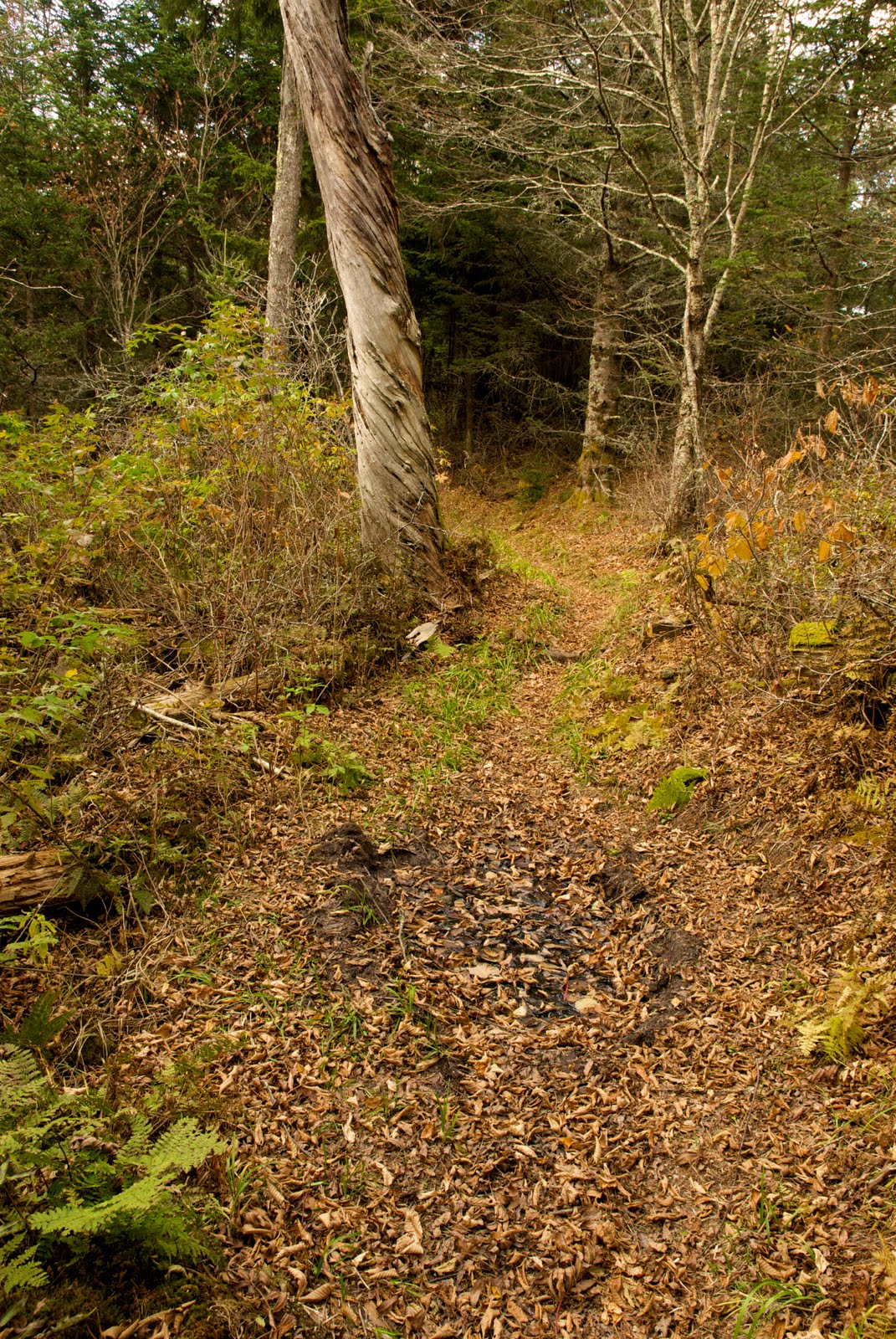 The guidebook mentioned wild pig wallows along this section of the trail - here's one.
 Balsam Mountain Trail views...
The hiking was easy and we made it to Laurel Gap by 5 pm to find the shelter fenced in to keep the bears out – PROMISING FOR CORKY! Harry scouted for the loo while Corky and I hiked downhill to the water source. Harry had no luck finding the latreen and broadcast a $10 challenge to anyone who could find it. Corky took up the challenge and I started to boil water for dinner.
 Laurel Gap Shelter with bear fence
 Typical bear bag cable system we found on the AT in the GSM
Harry also produced some German hot chocolate packets for cocktails before the coos coos. Dinner was grand and we had a nice fire and conversation interrupted only briefly by the hoot of owls and calls of coyotes. The boys chained the entrance to the shelter and tested the bell on the chain so we could hear the bells if they messed with it. Nevertheless, Harry slept with the “persuader” close and ready for action. Rain penetrated my subconscious as I floated in and out of sleep.
Wednesday, October 20, 2010. Laurel Gap Shelter to Round Bottom Horse Camp
We woke up to on and off rain and found that no bear had messed with the lip balm and gum that was left out overnight. Got the stove going boiling water and took Harry’s 10 buck challenge to find the “shitter” (Corky’s term). Hiked ~ ½ mile up two different trails but to no avail. Surmized that “toilet area” on the sign meant “dump in the woods”. At least this way Harry would get the full backpacking experience all in one trip – rain (check), dump in the woods (check). Did my business and came back to cold oatmeal, but at least had a double cappacino packet thanks to Harry’s travels abroad.
Got the raingear and pack covers on and hit the trail.

Unwelcome ups to start off but we were headed downward soon enough. We continued down Balsalm Mountain Trail towards Straight Fork Road(trail's end)and peeled off layers as we built up steam and the sun began to peek out of the clouds. We made it to the Beech Gap Trail junction in no time - only about 2.3 miles to go.

The trees in the woods surrounding the trail were colorful and beautiful.
 Even in the rain, the woods were beautiful!
Continuing down, we ran into a horseback party heading up the trail. It was amazing how sure-footed those animals and how confident their riders were! As they passed and stopped for a break, we lusted for the cold beers they produced out of the saddlebags. Somehow we felt more deserving….

The last mile at the bottom of the trail was very rocky and wet, but the thought of a pizza dinner with beer purred us on. We made it to the end of the trail where it intersected with the Straight Fork Road (dirt road)and hike the approximate ¾ of a mile to the Round Bottom horse camp. We tried to call our shuttle driver, but there was no cell service so we relaxed, pumped water, Harry made us some green tea, and we had lunch.
 We made it!
 Last of the backpack lunch!
We helped one of the camp’s horses that had gotten tangled up in a blanket strap as we waited for our ride.

After a couple more unsuccessful tries at getting cell service, I decided to take advantage of the Raven Fork stream across the street to see if I could coax a fish out of it. Caught a nice little rainbow trout right off the bat on a #16 Henryville Special, and then missed a succession of his faster cousins upstream on Adams and Caddis patterns. It seemed like you got one shot and if you missed you had to change flies. It was a fun diversion.
 Raven Fork Rainbow
We started to worry, but Bill arrived a little late at 4:15 and gave us our ~ 45 minute $ ______ ride back to Smokemont. We threw our stuff in the van and beat feet to the visitor’s center at Oconaluftee to pick up a few things for our families. In the fading light, we got a picture of the GSM sign and got on the Blue Ridge Parkway to give Corky one last shot at seeing a bear. No luck and a disgruntled Corky complained that bears are uncooperative and not his favorite animal any more. Humpf! Unfortunately, this is the only bear Corky saw the whole trip!

Stopped at the Big Witch OVerlook for one more picture of the Pisgah National Forest.


Got off the BRP at Sago Gap and flew to Ashville for pizza and Brooklyn browns at Vinnie’s (reasonably priced and highly recommended!). Got totally stuffed and then drove an hour more back to the Best Western in Hickory NC. Had a wonderful shower and then watched the San Francisco Giants beat Philly (Fear the Beard!) and then went to bed.
Thursday, October 21, 2010. Hickory, NC to Virginia Beach, VA
Got up and indulgently showered again! Harry insisted that Corky could not go back to OZ without a Waffle House experience. Luckily, there was one across the street. There were three of us so we could legally sit in a booth. We stuffed ourselves again – erasing any weight loss benefit the backpacking might have provided. C’est la vie! The miles peeled away. We stopped at Emporia for a late lunch – more sensibly at Subway this time - and then made our way home.
Awesome trip. Looking forward to exploring more of the Great Smoky Mountains!
1 comment:
quite a list of accomplishments. I am also a amateur photographer. It is hard not to get good pictures here in Kodiak. Check out a website of Kodiak Alaska I put together with photos from some of us here.
http://kodiakphotogroup.webs.com/
The contact info is not correct
Post a Comment