Showing posts with label Appalachian Trail. Show all posts

Saturday, May 14, 2011

McFee Knob and Tinker Cliffs Hike April 29- May 1, 2011 (Click on the pictures to enlarge them)

Getting ready to hike the John Muir Trail later this summer and wanted to do a shakedown weekender to make sure the gear was working well and ID any necessary repairs or other needs.

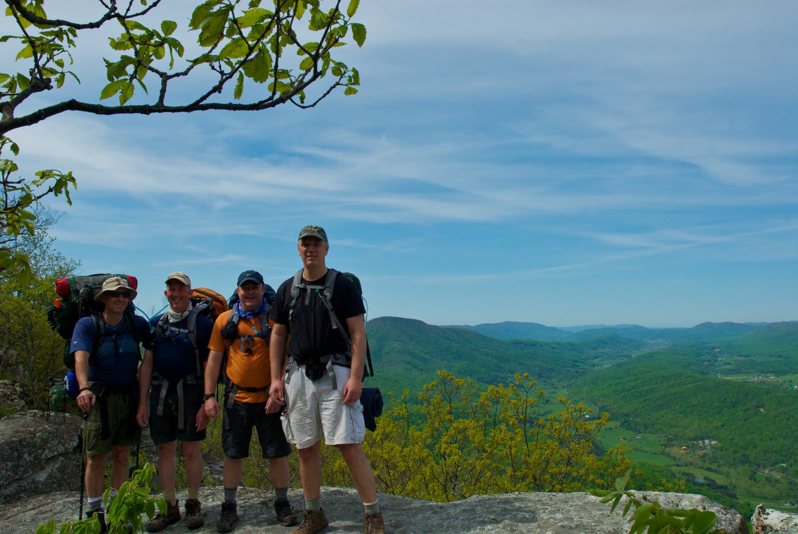
My friend Chis recommended an overnight hike up to McAfee Knob and said we wouldn't regret it. We were joined by our friend Harry (who had backpacked with me in the Smokies last October) and Noel (a friend of Chris' and an avid AT section backpacker).

Friday, April 29, 2011

We left after work on Friday and drove past Roanoke to the Dragon's Tooth trailhead parking lot on Rt. 311. We got in around 11 pm and pitched the tent in a grassy spot off the stone parking area. Chris thought this would be a good place to camp since there's a good bathroom available at the trailhead.

Saturday, April 30, 2011

We got up the next morning, swung by a mini mart for some not-so-good coffee and sweets, and made it to the parking lot where Rt. 311 crosses the AT.


This was going to be the end of our hike, and it is also where we had out shuttle driver ( Homer Witcher: 540-266-4849) pick us up to take us to the starting trailhead - Andy Layne Trail. Homer charged the four of us $20 for the shuttle - a good deal! We got to the Andy Lane Trail about8:45 am and started our climb to the first destination - the Tinker Cliffs.


The hike started out easy with some fence and stream crossings before the trail started to climb.


It was steady going up, but not that difficult it seemed. We took breaks where we needed them and we were in no particular hurry so we just made our own pace.


It was a beautiful day and perfect weather for hiking. You could tell as we approached the Tinker Cliffs, because these huge rock formations began to jut out of the ground.


The rock formations at Tinker Cliffs were spectacular as was the view!


At Tinker Cliffs we met a group of college students from Michigan who said they were taking their outdoor course final with a backpacking trip on the AT. Man, I wish they had those courses back when I was a student!. As we hiked away from the cliffs, we continued to enjoy the views, the flowers, and the rock formations jutting from the ground.


We were headed to the Campbell Shelter and had some more climbing to do.


More pretty flowers and rocks...


We made it to the Campbell Shelter by about 3 pm. and got the tents and hammock up, and we pumped water for the evening meal and to have a relaxing beverage. Harry always comes through with some specialty instants that he hocks during his international flights.


We lounged around, some more than others, as we greeted other hikers, and waited for our evening assault of McAfee Knob for the sunset views. Here's a picture of a Nixon at rest.


Without packs, we bounded up the trail for about 3/4 of a mile to McAfee Knob. No wonder this is such a popular spot. The views are spectacular! If you click on the picture of Noel (below) it will enlarge, and you can see the Tinker Cliffs on the peak at the end of the ridge over his right shoulder.


Here's a picture of Harry on the Knob

Momma don't like this picture...


Even messing with the camera settings, I had a hard time capturing the sunset. Even as the sun went down, the sky was still bright and I just couldn't capture the scene with my electrons. Hope my memory will serve me well.


Back at camp, we listened to some thru-hiker stories as we sat around the campfire. Sleep came easily.

Sunday May 1, 2011

We got up, made breakfast, and pumped water. We gave our extra food to the thru-hikers. I tried to offer a packet of instant hot cider, but one of the thru-hikers flipped the packet over and complained about the low caloric content and mumbled something about making it would be a waste of fuel. Apparently we messed around too much, because we were the last to leave Campbell Shelter.

We hiked up to McAffee Knob, with packs this time. The view was still great, but what it showed us was a rapidly approaching front - the rain was coming earlier than we planned.


We hoofed it down the trail to the parking lot where Rt. 311 crossed the AT. The rain was only intermittent and after about 1.5 miles we shed the rain gear. The trail was good and the hiking mostly easy with some ups, but not too bad.


Even with the rain in the forecast there were lots of day hikers headed for the Knob from the Rt 311 parking lot. We continued on and made it to the car without incident. Still raining on and off, we made it to Rt. 81 and pulled off for some post hiking grub. By the time we made it back to Virginia Beach, the sun was shining - another beautiful day to be alive!

Tuesday, May 19, 2009

Hike to the Devil's Marbleyard

Natural Bridge, VA
May 15-17, 2009


On May 15, 2009, I left Virginia Beach with my friend Chris to accompany a group of Boy Scouts on an outing to the Devil’s Marbleyard in the Jefferson National Forest around Natural Bridge,Virginia. With a nod to the safari zoo, the defunct looking 10 commandments park, and “Foamhenge” up on the hill, we finally arrived at the trailhead parking lot at around 11:00 pm. The guides were not kidding, parking was limited and nearly full, but we managed to wedge our car in so we were parking legal.

Headlamps blazing, we made our way across the Elk Creek Bridge, up the blue-blazed Belfast Trail, past the stone pillars of the old Powhatan BSA summer camp, and joined our troop in the camping area next to the old camp building foundations.

Here's the bridge as seen in the daylight.


Luckily, we had a car-camp tent erected and waiting for us so all we had to do is let the pads self inflate and roll out the sleeping bags and hit the hay.

Saturday morning, we awoke to survey the kid chaos and make some breakfast. Standard fare – oatmeal, granola bars, and black coffee from Chris’ Jetboil French press. We packed up the car-camp tent, made a short foray to the country store back down the road for the comfort of a porcelain seat, and then we were ready to head out.

Because the weather was threatening to get worse as the weekend progressed we had decided to do the circuit hike in reverse, do most of the hiking on the first day, get the most out of the scenic views while the weather was good, and hit the oddity of the Devil’s Marbleyard on the shorter second hiking day.

We crossed a small creek and made our way to the Glenwood Horse Trail – marked with orange diamonds.


If you look at the Hiking Upward website’s topo map of the trial, you’ll see that the trail undulates up and down on a very easy grade between about 1,040’ and 1,200’. From the GHT trailhead we crossed a small stream and hiked about 2 miles on an old Forest Service road until we reached the junction with the Gunter Ridge Trail (GRT). We took a short break here and rejoined the “Alpha” team of fast assault scouts (we were in the “Beta” team), and waited for the “Omega” group to show so we could stay in communication.


The GRT is not blazed, but was easy to follow. We crossed Little Hellgate Creek, went through a wooden horse gate and then began a climb through about 20 switchbacks (the website says 14) to take us from about 1,000’ to 2000’ in about a straight line mile (probably twice that distance in total miles hiked). I didn’t find the switchback section too difficult, but we stopped at the top of this section to reconvene with the Alphas again and have lunch.

The next section I thought was more strenuous – going form about 2,000’ to 2400’ in 2/3 of a mile with no switchbacks. Once we got up on Gunter Ridge, we hiked along a section where a lightening fire in 2002 burned the mature trees and opened up some spectacular views to the south.


We continued on to the campsite at the intersection of the GRT and the Belfast Trail at 2517’ – about 6.5 miles to that point.


It was hot on the march up to the top of the Gunter Ridge and we quickly pitched tents and hammocks spurred on by the boom of thunder and the threat of a late afternoon thunderstorm. This was the maiden voyage for my new Big Agnes Copper Spur UL2 tent and it set up in no time. Even without instructions, the color-coded stakeouts made attaching the footprint, and fly a snap. The hubbed pole design was new to me, but easy to understand and install. The BA Copper Spur UL2 was compact for sure, Chris is 6’4”, but we fit nicely and could get the packs squared away under the dual vestibules.

After a brief respite, we decided to capitalize on the nice weather and make the 3 mile RT hike to the lookout along the un-maintained Sulpher Spring Trail, aka the “Helicopter Pad” – a 30 yard offshoot of the Appalachian Trial. To get there, it took us about 40 minutes without packs to hike 1.5 miles through a saddle, up and down between 2,600’ and 2,400’. The views, however, were well worth the effort.


We made quick work getting back to camp, had dinner and retired right around dusk. Just as we got settled, the first drops of rain began to fall. Lightening lit up the tent, and the crack of thunder immediately flowed. No dead trees around us right? And then the skies opened up! We had a torrential downpour!

Sure enough, the next morning, there were some casualties among those without flies, those with bargain tents and half flies, etc. I’m continually amazed at the nonchalance of the Scouts regarding getting wet. However, as an adult, with a Montbell down bag, I’m very glad the Big Agnes tent (with full fly and vestibules) kept us and our packs bone dry. When it got light out, I was slightly disturbed to note water and flotsam between the footprint and the bottom of the tent well. How did the water get there? It was even more distressing when, helping the Scouts break camp, the undersides of their tents were dry. It dawned on me when I helped take down the hammock pitched next to our tent. The Scout erected his hammock fly so that it directed all his rain directly at my tent’s sidewall creating a gulley washer under my tent! The BA still stayed dry! However, next time I won’t pitch anywhere near those ditzy kids.

I helped pack up the Scouts, got my own tent down, and we made a hasty breakfast to get back on the trail and home. A sign at our campsite pointed us back down the ~ 1 mile of unblazed Belfast Trail towards the Devil’s Marbleyard. The descent was easy with only a few rocky and steep sections that caused me to slow down and watch my step. The Devil’s Marbleyard was cool, and the views to the west across the valley were very nice.


With the previous night’s rain, the Belfast Creek that parallels the trial was swollen and the rushing water and numerous waterfalls made for many a picturesque scene. The Hiking Upward website rates the steams on this circuit hike as a 1 out of 5. Maybe this would be true in summer when flows are down, but on our hike, I would say that Belfast Creek rated a 4 out of 5 minimum!


From the Marbleyard, it was an easy mile with a couple of stream crossings back to the campsite, across Elk Creek Bridge and to the cars. This time, although the weather report was dicey, I managed to avoid hiking in the rain, our views were not blocked by clouds and stormy weather, and we ended up the hike relatively pain-free – all pluses! In all, including the 3 mile hike to the Sulpher Springs lookout, we covered about 11.5 miles in two days – a thoroughly enjoyable trip and distance.

Note: All pictures posted were taken with a Cannon Power Shot SD880 IS digital elph carried in a 1010 Micro Pelican Case Series latched with some cord and S-biners to my shoulder straps and across my chest for easy access. This system worked great!